Here is the important hint:
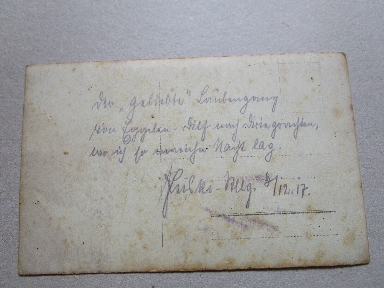
Puski - Stllg. 9/12.17.
The first letter starts with an upper length and a long downward stroke like the German ſ. The only uppercase letter written that way in Kurrent is the P. If you consider the loop on the lower length to be rushed, and the third loop to the left to be too large, it fits this model:

Stllg. is an abbreviation for "Stellung", position.
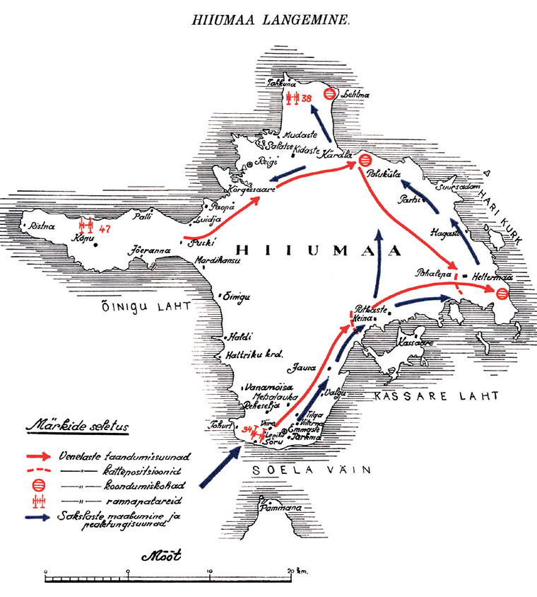
The Estonian village of Puski on the island of Hiiumaa) became the site of Russian fortifications in 1917. German invaders took Hiiuma between the 12th and 19th October. A book about Estonian General Nikolai Reek and German Operation Albion has a map on p. 355. Puski is on the narrow leading to the western peninsula:

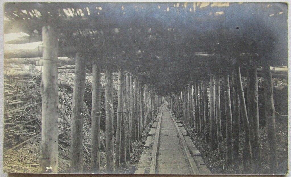
General Reek describes the way trenches were built by the Estonian/Russian defenders (p. 241):
The stony surface of the peninsula made the construction of trenches more difficult; therefore, all the trenches on the coast were built upon the surface. In the middle part of the peninsula, there is situated a ridge extending from the east to the west; at two places it widens, forming groups of higher hills. The first group of hills is situated at Kõpu, Surepi, and Mägipe, and the second group on the isthmus near Kopa and Puski villages.
On the peninsula, trenches were planned:
- ...
- on the isthmus in the area of Villamaa, Kopa and Puski villages, 10 trenches which had to block the advance of the enemy from the peninsula inland; a part of the trenches were situated on the top of the sand hills; part of the trench weapons were also decided to place on the same position.
The strange thing is that the withdrawal of the Russian/Estonian troups was relatively swift, so why would German soldiers patrol trenches that far from the front, which, when the card was written in December, was the strait between the islands and the mainland?
In general, the handwriting on the card is relatively precise and readable. There is only one letter where I have doubts:
von Eggelen-D?lf nach Dringrachten
Interpretation of the second letter in the next word as an i is not very probable, as in all other cases the dot of the i is written clearly separated, while here the pencil moves in an uninterrupted upswing.
A dictionary of Estonian placenames has "Egelen" as a swedish word for "island" and especially the Swedish-inhabited part of the Estonian islands in the 17th century (Translated with DeepL.com):
Aiboland [aibo‿`land], kohalikus pruugis Aibu ~ Äibo – eestirootsi asustusala Harju, Hiiu, Lääne ja Saare maakonnas.
- Rahvusromantiline nimi, mida on kasutatud XIX saj-st alates kogu eestirootsi ala kohta, tuleneb eestirootsi sõnadest aibo ’saareelanik’ ja land ’maa’. E. Lagmani järgi on see tuletatud ürikutes esinevast nimest (1391 Eyland, 1449 Elandt, 1565 Eyelandt, 1685 Egeland), mis haaras rannikut Sutlepast kuni Spithamini. 1449 on nime Elandt mainitud saarenimena (insula), arvatavasti seetõttu, et ülejäänud nimed loetelus tähistasid saari. Nime algusosa ey- ~ ege- on sama mis eestirootsi ai ~ äi ja rootsi ö ’saar’, seega tähendab nimi saaremaad.
Aiboland [aibo‿`land], locally Aibu ~ Äibo - Estonian-Swedish settlement area in Harju, Hiiu, Lääne and Saare counties.
- A vernacular name, used from the 19th century onwards for the whole of the Estonian-Swedish area, derived from the Estonian-Swedish words aibo 'islander' and land 'country'. According to E. Lagman, it is derived from the name in the records (1391 Eyland, 1449 Elandt, 1565 Eyelandt, 1685 Egeland), which covered the coast from Sutlepa to Spitham. In 1449, the name Elandt is mentioned as an island name (insula), presumably because the other names in the list referred to islands. The initial part of the name, ey- ~ ege-, is the same as the Estonian Swedish ai ~ äi and the Swedish ö 'island', so the name means island land.
The same dictionary says the village of Rahu on the neighboring island of Saaremaa had the German name "Rachte", but no hint of the leading "Dring". Also, it is in an area (the southeastern coast) that according to Reek (p.198) had no fortifications.
 Quelle: Wikimedia Commons
 Quelle: Wikimedia Commons

